Maps
 Homelands (Bantustans)
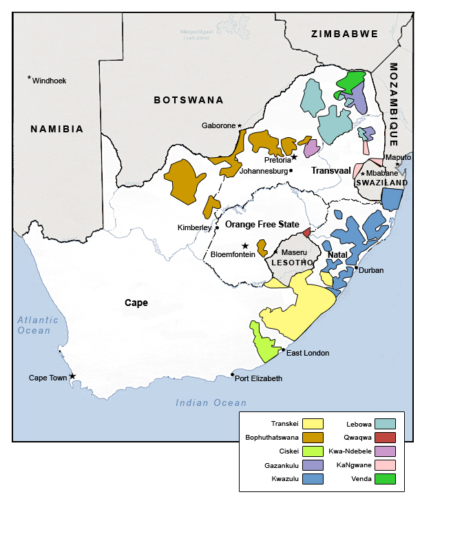
1984 MATRIX, Michigan State University
The South African government designated all Africans as citizens of a homeland or Bantustan. By 1984, Ciskei, Bophuthatswana, Transkei, and Venda had been granted "independence," which was recognized by no other nations except South Africa.
 Homelands (Bantustans) and Agricultural Resources, 1984
2007 MATRIX, Michigan State University
This map shows the boundaries of the ten homelands or Bantustans along with the location of land that can be used for agriculture.
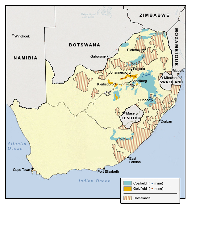 Homelands (Bantustans) and Gold and Coal Mining, 1984
2007 MATRIX, Michigan State University
The territory designated for ten African "homelands" is shown with deposits of gold and coal and the existing mines.
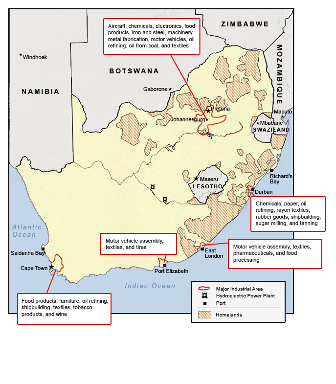 Homelands (Bantustans) and Industrial Areas and Ports, 1984
2007 MATRIX, Michigan State University
This map shows the territory of the ten homelands designated by the apartheid government along with the major industrial areas and ports.
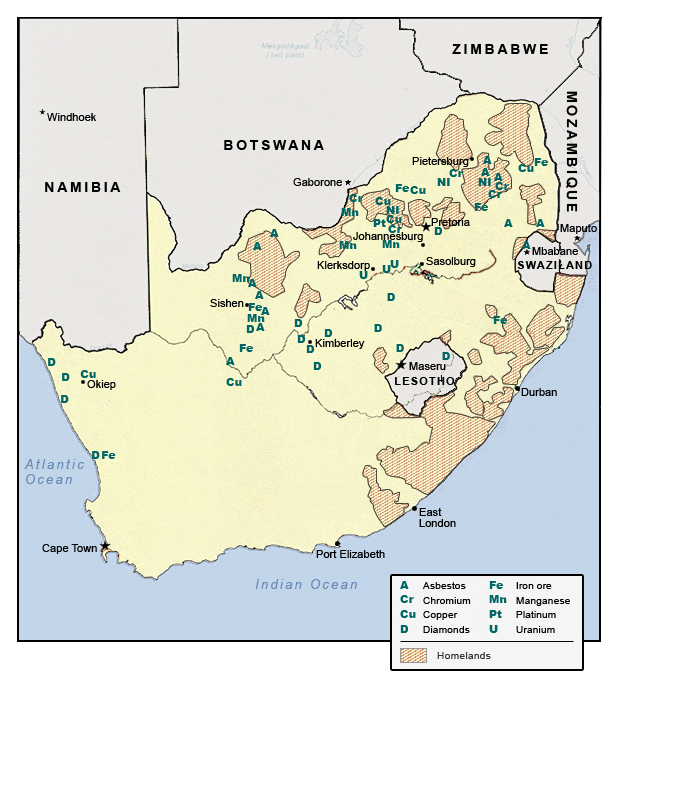 Homelands (Bantustans) and Mineral Deposits, 1984
 2007 MATRIX, Michigan State University
This map shows the boundaries of the homelands along with mineral deposits, other than gold and coal.
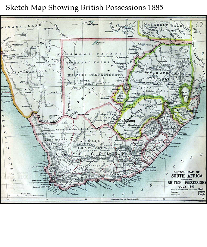 Sketch Map of South Africa showing British Possessions, July 1885
1885 Scottish Geographical Society
Map showing British, German, and Portuguese possessions in 1885.
 South Africa: Agricultural Resources
2006 U.S. Central Intelligence Agency
Agricultural land and major commercial crops are shown here.
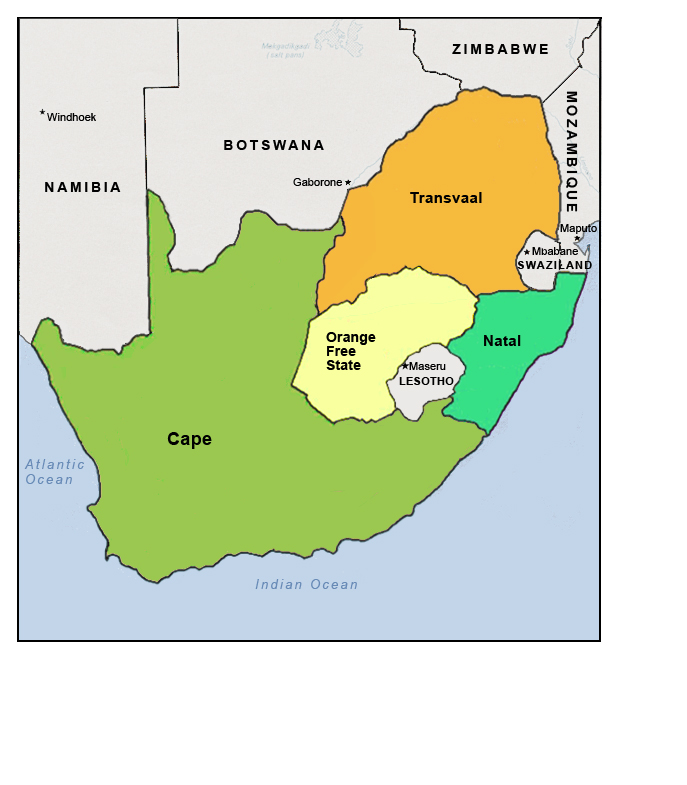 South Africa: Former Provinces, 1993
MATRIX, Michigan State University
The four provinces in South Africa during the apartheid era.
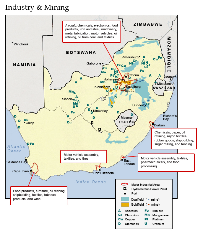 South Africa: Industrial Areas, Mines, and Ports
2006 MATRIX, Michigan State University
Major industrial areas, including mining, and the six major ports are shown here.
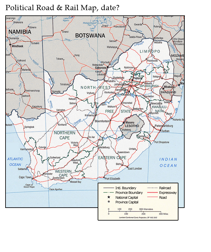 South Africa: Political and Transportation Features
2007 U.S. Central Intelligence Agency
Provinces and major cities, roads, and railways are shown in South Africa and into neighboring countries.
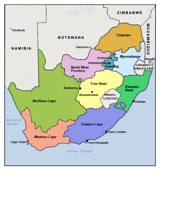 South Africa: Provinces and Major Cities
2007 MATRIX, Michigan State University
Major cities and provinces in post-apartheid South Africa.
 South Africa: Vegetation
2006 U.S. Central Intelligence Agency
This map shows the diverse forms of vegetation in different parts of South Africa.